Digitaal topografisch bestand (dtb) eu
Dataset
Description
Digitaal Topografisch Bestand van de infrastructuur in beheer bij Rijkswaterstaat opgebouwd uit punt-, lijn- en vlakinformatie. Deze kopie van de data (zonder z-waardes) is aangemerkt als AS-IS bron voor EU-doelen. De RWS levering vindt plaats via Digitaal Topografisch Bestand - DTB - lijnen (RWS) of (punten of vlakken)
Status
- Disclosure level
- Public
- Available since
- Updated
Features
- High value
- Basic register
Ownership
- Source catalog
- Dexes marktplaats https://open.dexspace.nl
Contact
- Name
- Rijkswaterstaat
- servicedesk-dat@rws.nl
Metadata
- Identifier
- https://nationaalgeoregister.nl/geonetwork?uuid=c4b137b8-2317-42c2-aced-204c4216d68d
- Metadata language
- Dutch
Distributions (11)
Punten
accessPoint
- License
- CC-0 (1.0) http://creativecommons.org/publicdomain/zero/1.0/deed.nl CC-0 (1.0) http://creativecommons.org/publicdomain/zero/1.0/deed.nl
- Format
- OGC:WMS
- No policies are applicable for this dataset Ask for more information or send an access request
Policy
Lijnen
accessPoint
- License
- CC-0 (1.0) http://creativecommons.org/publicdomain/zero/1.0/deed.nl CC-0 (1.0) http://creativecommons.org/publicdomain/zero/1.0/deed.nl
- Format
- OGC:WMS
- No policies are applicable for this dataset Ask for more information or send an access request
Policy
Vlakken
accessPoint
- License
- CC-0 (1.0) http://creativecommons.org/publicdomain/zero/1.0/deed.nl CC-0 (1.0) http://creativecommons.org/publicdomain/zero/1.0/deed.nl
- Format
- OGC:WMS
- No policies are applicable for this dataset Ask for more information or send an access request
Policy
Digitaaltopografischbestand:punten
accessPoint
- License
- CC-0 (1.0) http://creativecommons.org/publicdomain/zero/1.0/deed.nl CC-0 (1.0) http://creativecommons.org/publicdomain/zero/1.0/deed.nl
- Format
- OGC:WFS
- No policies are applicable for this dataset Ask for more information or send an access request
Policy
Digitaaltopografischbestand:lijnen
accessPoint
- License
- CC-0 (1.0) http://creativecommons.org/publicdomain/zero/1.0/deed.nl CC-0 (1.0) http://creativecommons.org/publicdomain/zero/1.0/deed.nl
- Format
- OGC:WFS
- No policies are applicable for this dataset Ask for more information or send an access request
Policy
Digitaaltopografischbestand:vlakken
accessPoint
- License
- CC-0 (1.0) http://creativecommons.org/publicdomain/zero/1.0/deed.nl CC-0 (1.0) http://creativecommons.org/publicdomain/zero/1.0/deed.nl
- Format
- OGC:WFS
- No policies are applicable for this dataset Ask for more information or send an access request
Policy
Digitaaltopografischbestand (dtb) - dtb_punt.gpkg
accessPoint
- License
- CC-0 (1.0) http://creativecommons.org/publicdomain/zero/1.0/deed.nl CC-0 (1.0) http://creativecommons.org/publicdomain/zero/1.0/deed.nl
- Format
- ATOM
- No policies are applicable for this dataset Ask for more information or send an access request
Policy
Digitaaltopografischbestand (dtb) - dtb_lijn.gpkg
accessPoint
- License
- CC-0 (1.0) http://creativecommons.org/publicdomain/zero/1.0/deed.nl CC-0 (1.0) http://creativecommons.org/publicdomain/zero/1.0/deed.nl
- Format
- ATOM
- No policies are applicable for this dataset Ask for more information or send an access request
Policy
Digitaal topografisch bestand (atom)
accessPoint
- License
- CC-0 (1.0) http://creativecommons.org/publicdomain/zero/1.0/deed.nl CC-0 (1.0) http://creativecommons.org/publicdomain/zero/1.0/deed.nl
- Format
- ATOM
- No policies are applicable for this dataset Ask for more information or send an access request
Policy
Dtb iso19110 catalogus
[{"name":"THEMA","code":"","type":"0","description":"indien een lijn 2 functies heeft wordt 2e functie hiermee aangegeven","legend":[]},{"name":"THEMB","code":"","type":"0","description":"indien een lijn 3 functies heeft wordt 3e functie hiermee aangegeven","legend":[]},{"name":"OMSCHR","code":"","type":"0","description":"omschrijving van het object","legend":[]},{"name":"DATUM","code":"","type":"0","description":"datum inwinning","legend":[]},{"name":"GRADENHOEK","code":"","type":"0","description":"hoe waarmee puntsymbolen zoals vermarkeringen moeten worden weergegeven","legend":[]},{"name":"Z","code":"","type":"0","description":"Z-coordinaat van punten","legend":[]},{"name":"LAYER","code":"","type":"0","description":"hoogtelayer van het betreffende object, layer1 is maaiveld","legend":[]},{"name":"DTM","code":"","type":"0","description":"indien J dan beschrijft dit object het Digitaal Terrein Model","legend":[]},{"name":"DTB_ID","code":"","type":"0","description":"ID van het betreffende object","legend":[]}]
- License
- CC-0 (1.0) http://creativecommons.org/publicdomain/zero/1.0/deed.nl CC-0 (1.0) http://creativecommons.org/publicdomain/zero/1.0/deed.nl
- Format
- JSON
- No policies are applicable for this dataset Ask for more information or send an access request
Policy
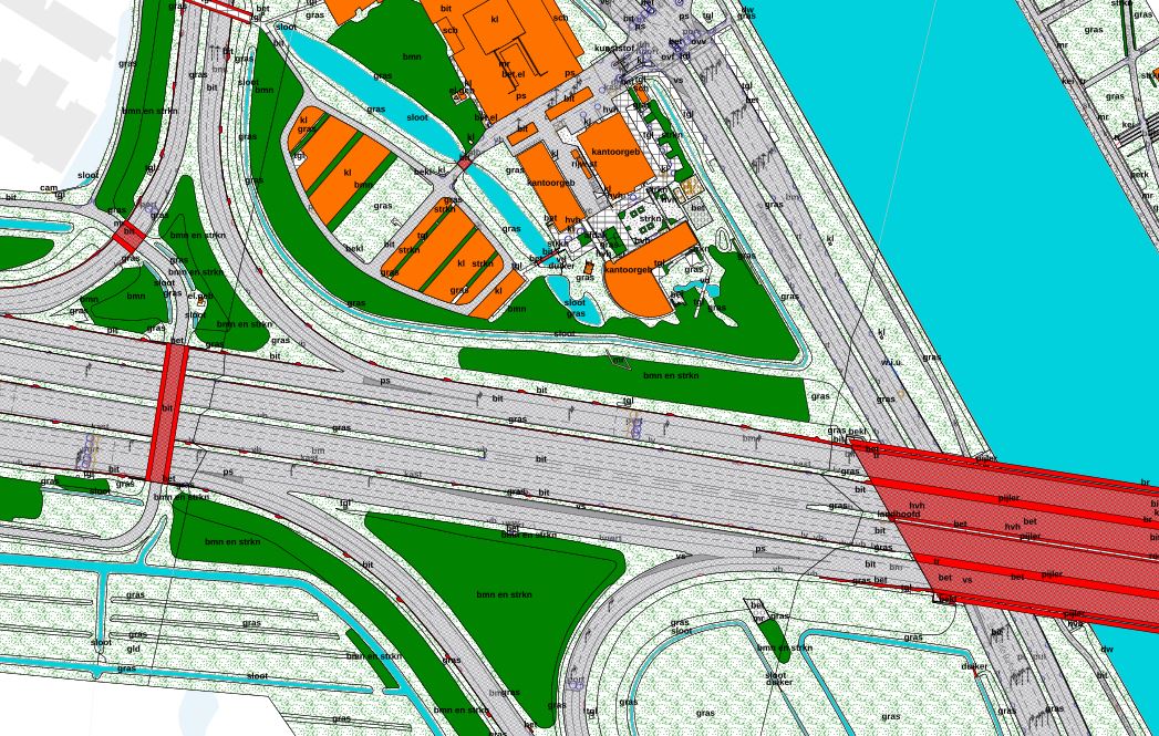
Gegenereerde grafische weergave
Dit is een grafische representatie van de dataset die via het NationaalGeoregister.nl aangeboden wordt.
Het is mogelijk dat deze grafische representatie geen weerspiegeling van de data is, maar dient als ondersteunende afbeelding. Indien de dataset via een OGC:WMS service aangeboden wordt, is het mogelijk om zelf een grafische weergave van de dataset te genereren.
- License
- CC-0 (1.0) http://creativecommons.org/publicdomain/zero/1.0/deed.nl CC-0 (1.0) http://creativecommons.org/publicdomain/zero/1.0/deed.nl
- Format
- JPEG
- No policies are applicable for this dataset Ask for more information or send an access request